Before MBS Environmental was formed, at our predecessor Martinick McNulty, we still produced reports, albeit these were mostly produced as hard copies for submission to regulators. These included maps and figures with the difference to now being that some of our cut and paste maps involved actual glue and scissors.
Our first digital camera had a neato 3.5″ floppy drive (aka 3D printed save icon) built in with 0.0014 GB capacity. Aerial photos were bought from Landgate as physical prints.
GPS was a game changer, replacing compasses and hard copy maps to get us around. Even with its built in 200 m inaccuracy (selective availability), it was better than trying to find something roughly penciled by eyeballing a 1:250,000 paper map.
By the time MBS was founded in 2002, the ability to provide GIS analysis mapping and other spatial services was essential and much easier.
Technology has continued to progress, and we are now spoiled for choice with data from free weekly satellite imagery from the EU’s Sentinel program or through government and commercial aerial coverage. For many projects we have the freedom to develop our own data using our own drones and GPS enable tablets are widely used to record monitoring data compared to the low-tech pencil and a waterproof notebook.
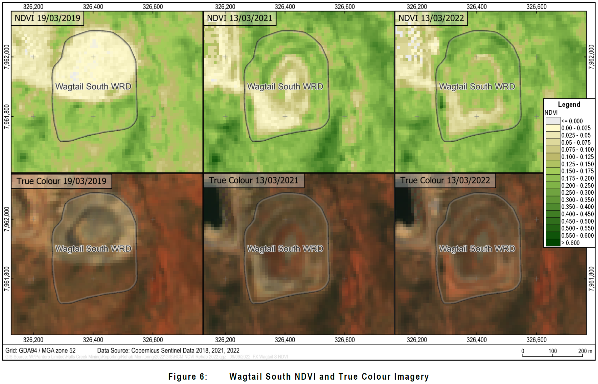
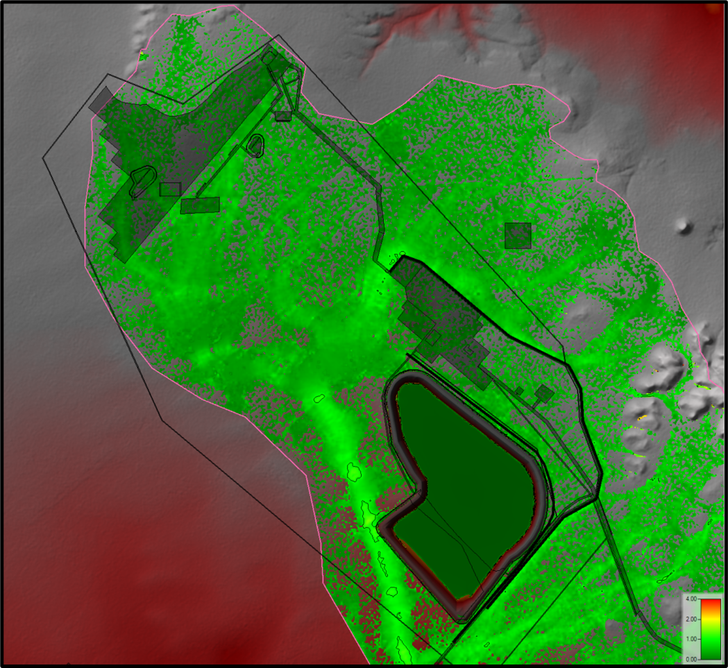
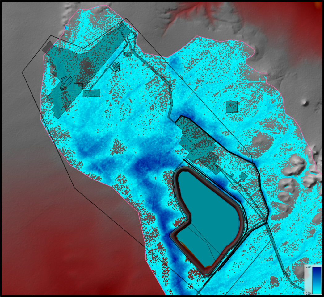
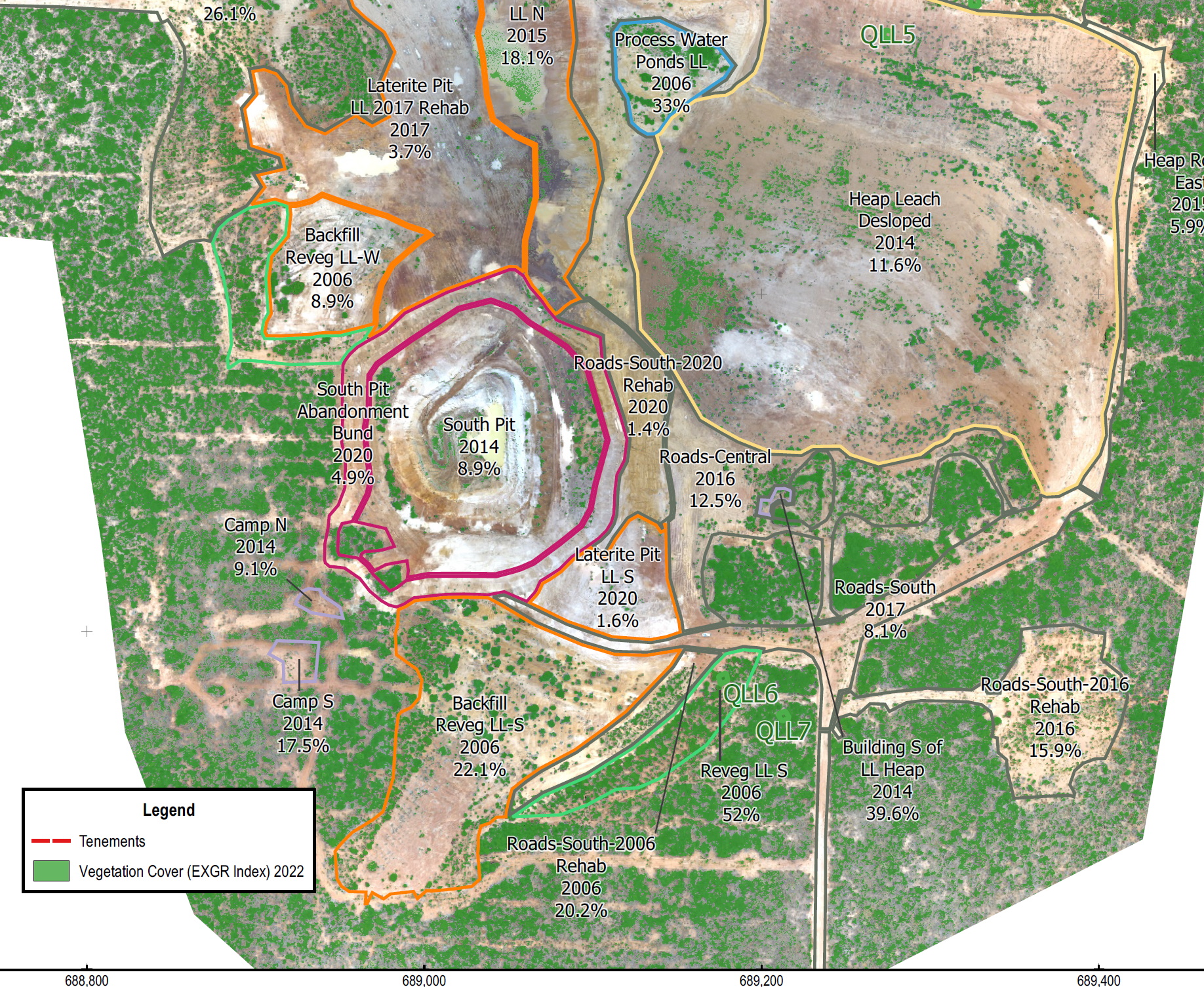
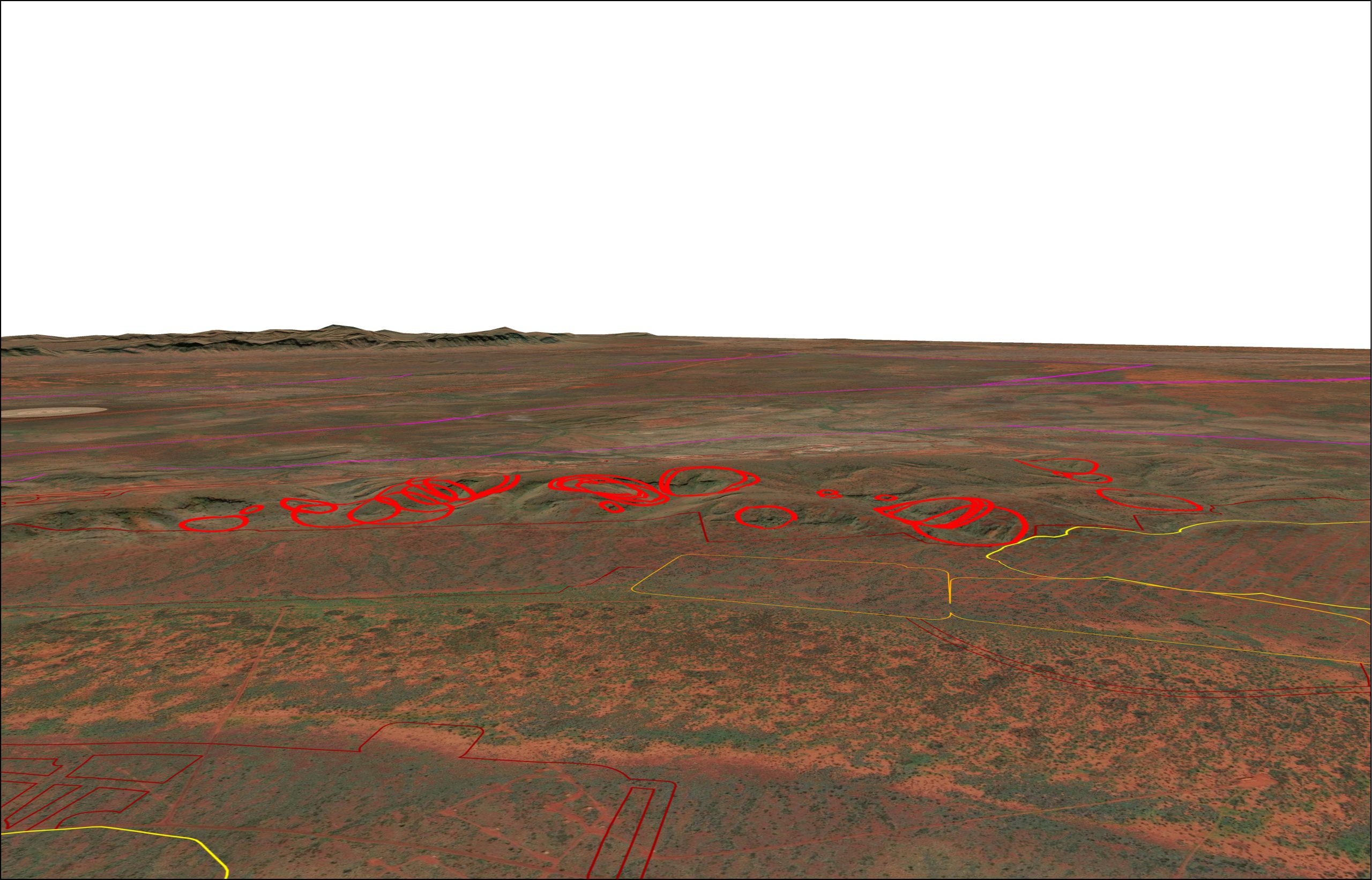
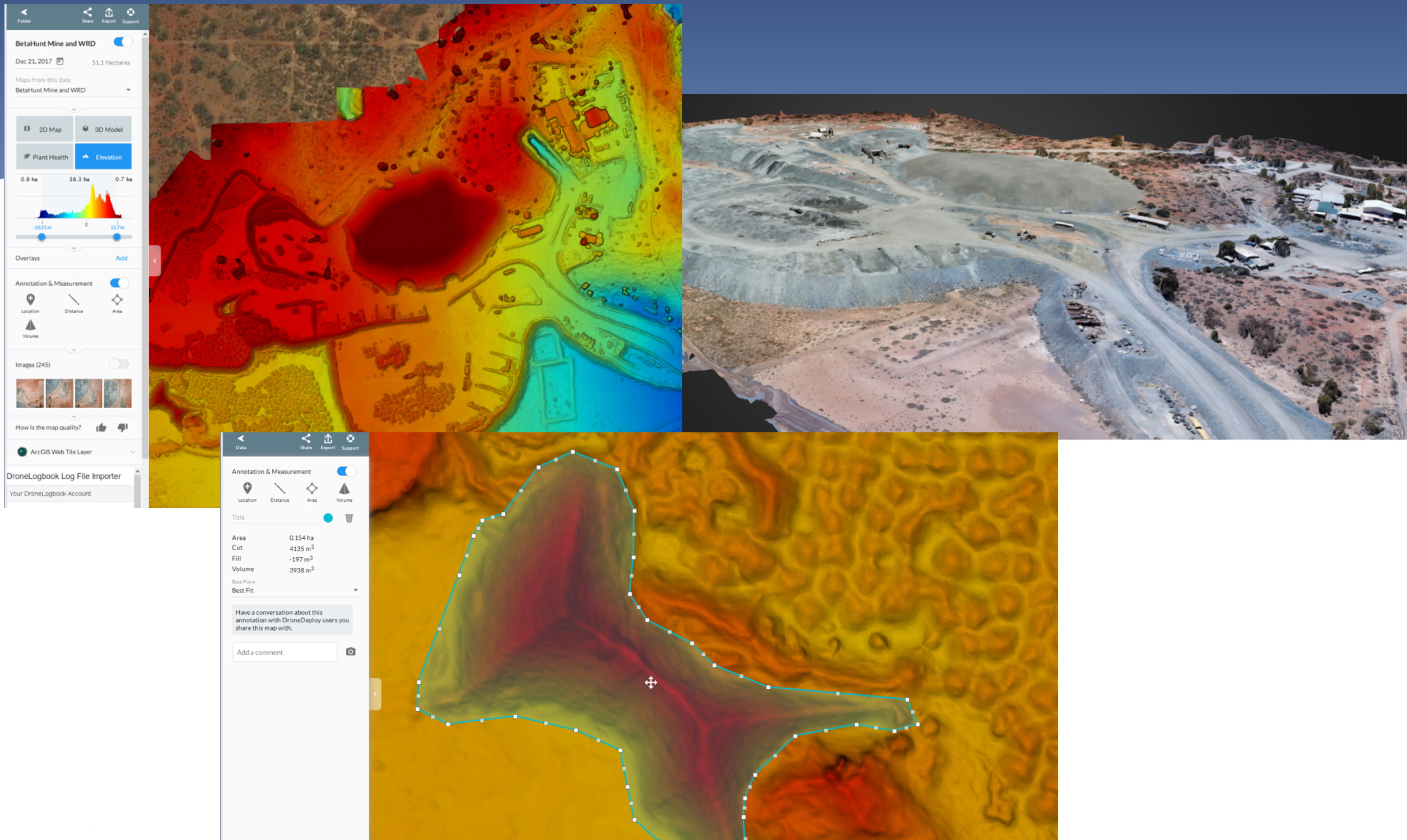
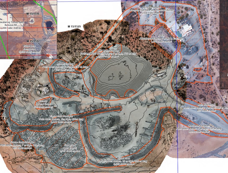
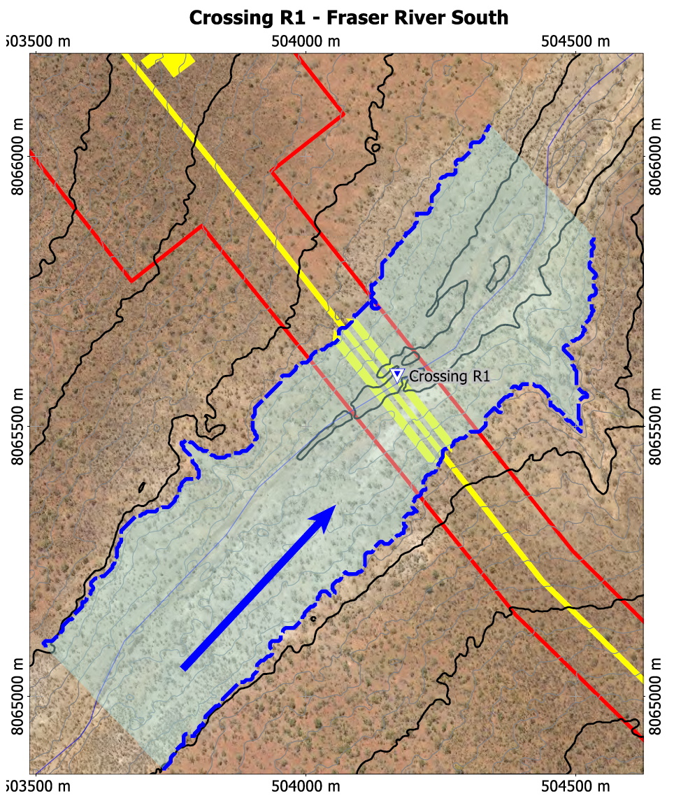
Some of the spatial products provided by MBS are in the pictures and include:
- Quantification of rehabilitation material volumes from drone survey.
- Hydrological analysis from DEM via 2D modelling.
- Vegetation cover and condition analysis from drone capture and satellite imagery.
- 3D visualisation for visual impact assessment.
- 3D presentation of fauna habitat analysis.